This workshop aims to introduce those interested in landscape evolution and source to sink problems to a new open-source code: pyBadlands. Note that you do not have to be a seasoned modeller to participate.
Geomorphologists, tectonicists and sedimentologists interested in testing conceptual models based on field observations are welcome!
When you use Badlands, please cite the following papers and/or code release citable DOI:
- Salles, T. & Hardiman, L.: Badlands: An open-source, flexible and parallel framework to study landscape dynamics, Computers & Geosciences, 91, 77-89, doi:10.1016/j.cageo.2016.03.011, 2016.
- Salles, T.: Badlands: A parallel basin and landscape dynamics model, SoftwareX, doi:10.1016/j.softx.2016.08.005, 2016.
- Salles, T. & Howson, I.: Release 1: badlands-model/pyBadlands, Zenodo, doi:10.5281/zenodo.160412, 2016.
Background on Badlands
a.k.a. Basin and Landscape Dynamics
The model's development started in 2015 and is part of the suite of tools from the ARC Basin Genesis Hub. Badlands is a landscape evolution model, built to simulate topography development at various space and time scales.
| Basin Genesis Hub presentation (2017) | Badlands overview |
Overview
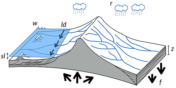
Badlands is a parallel TIN-based landscape evolution model, built to simulate topography development at various space and time scales. The model is capable of simulating hillslope processes (linear & non-linear diffusion), fluvial incision ('modified' Stream Power Law, Transport Capacity Law both for sediment erosion/transport/deposition), spatially and temporally varying geodynamic (horizontal + vertical displacements) and climatic forces which can be used to simulate changes in base level, as well as effects of climate changes or sea-level fluctuations. The model uses gFlex package which is designed to solve elastic plate flexure for applications to Earth's lithosphere.
Features
- The finite volume approach from Tucker et al. (2001) based on the dual Delaunay-Voronoi framework is used to solve the continuity equation explicitly,
- Node ordering is perform efficiently based on the work from Braun & Willett (2013),
- 3D surface deformations using the node refinement technique proposed by Thieulot et al. ( 2014),
- Orographic precipitation using Smith & Barstad (2004) linear model to compute topographic induced rain field,
- Varying erodibility layers (both horizontally and vertically) to simulate impact of changing sediment characteristics on landscape evolution,
- A set of functions for pre & post-processing of Badlands inputs and outputs is available in a GitHub Companion repository.
- Long-term evolution of longshore currents and induced sediment transport is simulated based on linear wave theory.
- Fuzzy logic approach is used to estimate carbonate growth based on depth, wave energy and sedimentation rate.
Community driven
This program is free software: you can redistribute it and/or modify it under the terms of the GNU Lesser General Public License as published by the Free Software Foundation, either version 3 of the License, or (at your option) any later version.
This program is distributed in the hope that it will be useful, but WITHOUT ANY WARRANTY; without even the implied warranty of MERCHANTABILITY or FITNESS FOR A PARTICULAR PURPOSE. See the GNU Lesser General Public License for more details.
You should have received a copy of the GNU Lesser General Public License along with this program. If not, see http://www.gnu.org/licenses/lgpl-3.0.en.html.
Requirements
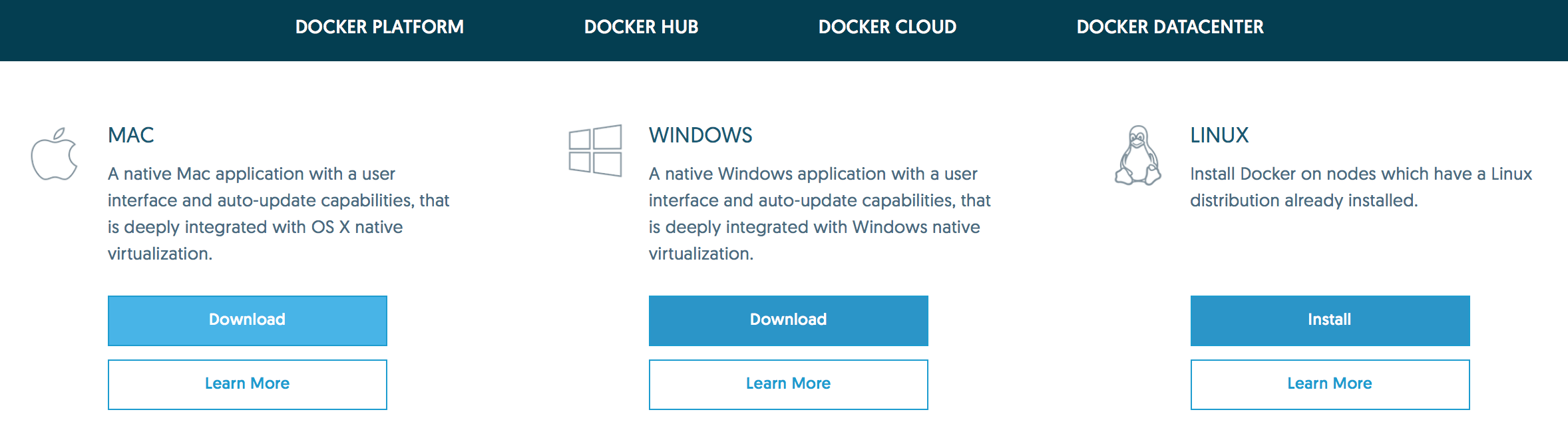
You will need to download the Docker application by clicking on the link and choosing the right one for your operating system.
You will also need Paraview data analysis and visualization application.
Resources
We will use Jupyter, a web application that allows you to create and share documents that contain live code, equations, visualizations and explanatory text. To access the workshop materials we will download via Kitematic a Docker container called pybadlands-demo. Please follow the documentation provided here on how to install the materials on your local computer or directly from the School's computer labs.
Some notes on how to use Badlands via Docker, setup initial models and run examples is available through the following links:
| HTML version (for Chrome or Safari) | PDF version |
- Companion
-
For pre- & post-processing it is also recommended to use the Companion which is already shipped in the Docker container.
Most of the information regarding how to use the tool are provided in Badlands wiki. - Input file
-
You can find the complete input file options with the different options available in the code.
- Pre-processing
-
Pre-processing options will enable you to create the input file for Badlands in the right format.
- Post-processing
-
Post-processing options contains a series of functions to analyse the outputs of Badlands model.
Hands-on examples
A compilation of notebooks with examples are available for the workshop:
| Type | Link |
|---|---|
| delta evolution under sea-level fluctuation | nbviewer |
| impact of climate on mountain dynamic | nbviewer |
| basin filling associated to a strike-slip fault system | nbviewer |
| infilling of a crater-type topography | nbviewer |
| flexural response due to loading and unloading under variable elastic thickness | nbviewer |
| quick setup of real topography/bathymetry model using etopo1 | nbviewer |
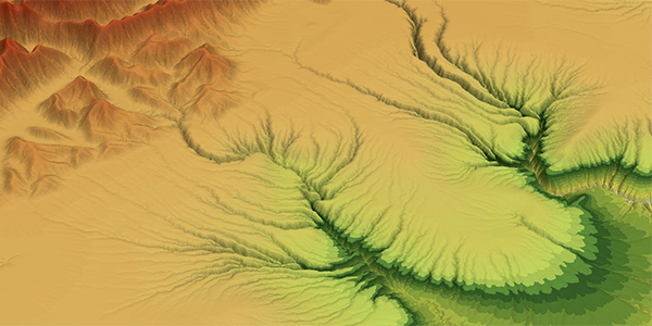
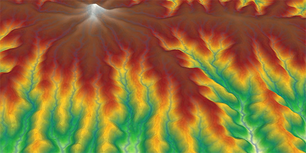
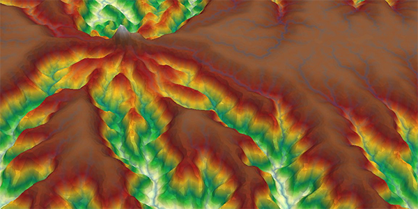
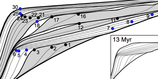
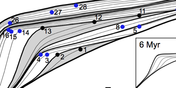
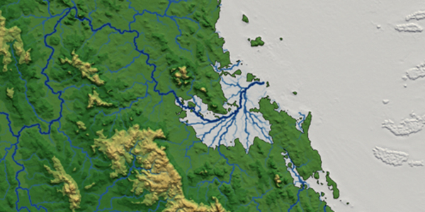
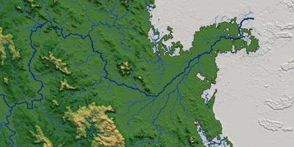
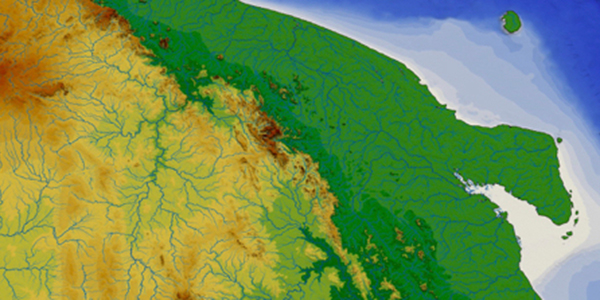
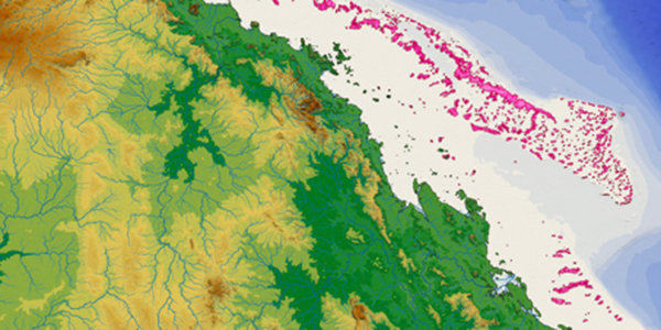
Examples of badlands outputs
Some questions?
If you come across a bug or if you need some help compiling or using the code you can:
- go through our mailing list archive.
- subscribe to our mailing list.
- or drop us a line.
Or simply fill out the form below