Total Sediment Thickness of the World's Oceans and Marginal Seas (Whittaker et al. 2013)

Sedimentary basins are regions where considerable thickness of sediments have accumulated. They are widespread both onshore and offshore.
In this module, we will investigate how facies classification, wells analyses and decompaction techniques could be used to characterise their formation and evolution and infer from limited dataset their sedimentary characteristics.
Lecture resources
This section lists the topics covered in the two lectures on sedimentary basins. Either of the following two books may be useful for an in-depth understanding and both can be found in the University Library.
- The Solid Earth: An introduction to global geophysics, C.M.R. Fowler.
- Basin Analysis: Principles and Applications, P Allen & J Allen.

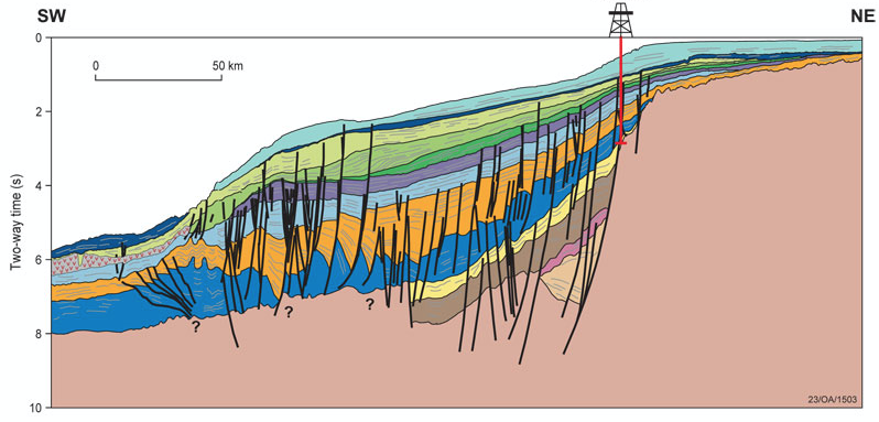
Recherche and Ceduna Sub-basins and Madura Shelf from Geoscience Australia
About 80% of the sedimentary basins on Earth have formed by extension of the plates (often termed lithospheric extension). Most of the remaining 20% of basins were formed by flexure of the plates beneath various forms of loading. Pull-apart or strike-slip basins are relatively small and form in association with bends in strike-slip faults, such as the San Andreas Fault or the North Anatolian Fault. Only a very small number of basins still defy explanation, although we suspect that at least some of these have a thermal origin.
In the first 2 lectures, we will discuss this classification and present results of numerical models developed within the EarthByte Group showing the formation and evolution of several types of these sedimentary basins. Then we will make a quick refresh on sequence stratigraphy.
Lecture 1
| HTML version (for Chrome or Safari) | PDF version |
Lecture 2
| HTML version (for Chrome or Safari) | PDF version |
Salt has played an important role in petroleum exploration since the Spindletop Dome discovery in Beaumont, Texas in 1906. Today, much of the prime interest in salt tectonics still derives from the petroleum industry because many of the world's largest hydrocarbon provinces reside in salt-related sedimentary basins (e.g. Gulf of Mexico, North Sea, Campos Basin, Lower Congo Basin, Santos Basin and Zagros). An understanding of salt and how it influences tectonics and sedimentation is therefore critical to effective and efficient petroleum exploration (Archer et al. 2012) .

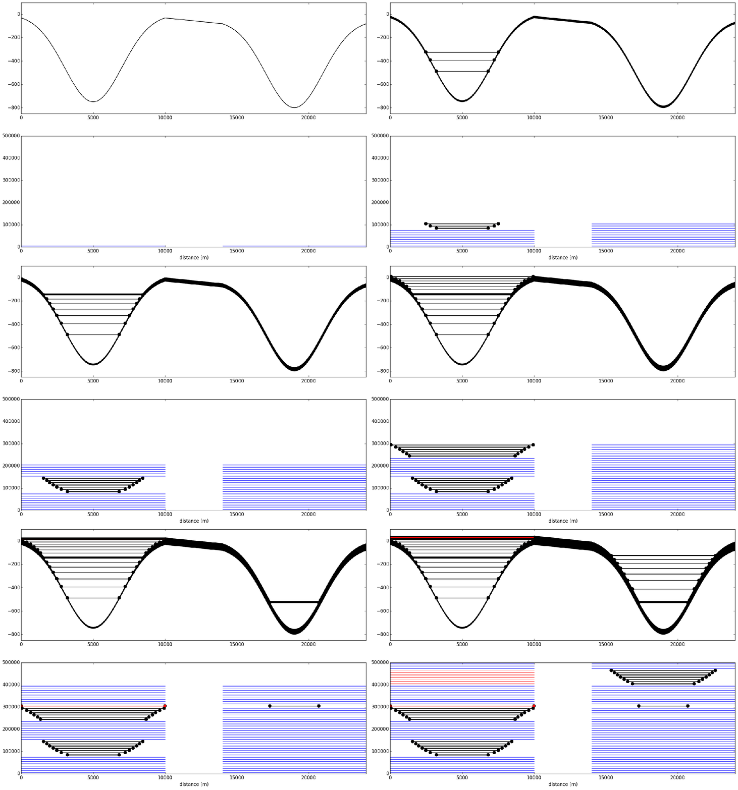
Static fill and spill model of minibasins sedimentation based on Sylvester et al. 2015.
In this third lecture, we will look at how basins containing salt evolve and deform through time. The addition of halokinetic processes to the geodynamic history of a basin can lead to a plethora of architectures and geometries. The rich variety of resultant morphologies have considerable economic as well as academic interest. To illustrate the interplay between salt tectonics and sedimentation, we will discuss the evolution of intra-slope minibasins in the Gulf of Mexico and present a simple model proposed by Sylvester et al. 2015 which helps in the understanding of how stratal termination patterns relate to variations in sediment input and basin subsidence.
Lecture 3
| HTML version (for Chrome or Safari) | PDF version |
For the labs
We will use Jupyter, a web application that allows you to create and share documents that contain live code, equations, visualizations and explanatory text. To access the module materials we will download via Kitematic a Docker container called usyd-sedbasinlabs. Please follow the documentation provided here on how to install the materials on your local computer (note that the tools are already installed on the School computer labs).
| Labs materials | Docker Container usyd-sedbasinlabs |
Going further
EGU 2014: Lithosphere dynamics, intraplate deformation, and sedimentary basins
Stratigraphic patterns in slope minibasins